Aerial drone view of Eagle River Valley, Colorado at sunset — UpDrone service area
Colorado Rocky Mountains
Based out of Eagle County, Colorado

Aerial
Intelligence

LiDAR surveying, thermal inspection, photogrammetry, and aerial cinematography for Colorado's luxury development and infrastructure markets.

0
Core Services
0+
TB Data Processed
SCROLL
SERVICES

What We Fly

LiDAR drone service — UpDrone
SERVICE 01
LiDAR
Light Detection & Ranging

Engineering-grade topographic mapping that penetrates vegetation to reveal true ground elevation. High-density point clouds for BIM integration and earthwork volumetric calculations.

CAPABILITIES
Topographic MappingPoint Cloud ClassificationVolumetric CalculationsBIM Integration
WHO WE SERVE
Civil Engineers
Luxury Developers
Ranch Owners
Learn More
ABOUT

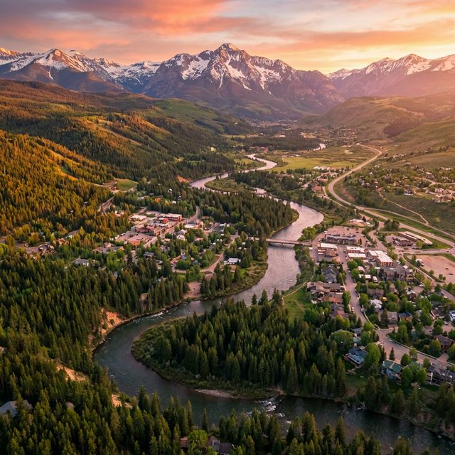
Built for the Mountains

UpDrone delivers high-precision aerial data services across all of Colorado — from luxury mountain builds in Vail and Aspen to Front Range development, solar farms on the Eastern Plains, and infrastructure across the Western Slope.

Based in Eagle County, our team combines deep drone operations experience with Colorado terrain expertise. We understand the altitude, the weather windows, and what your engineers and architects actually need.

Every project is a partnership — not a one-off flight. From pre-construction surveys to ongoing progress documentation, we're statewide and in it for the long build.
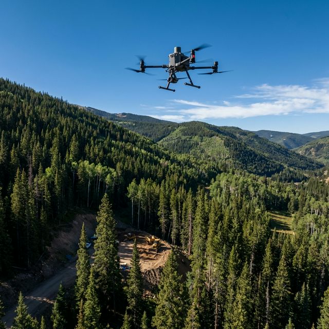
Our Equipment

DJI Matrice 350 RTK
Enterprise workhorse — IP55, 55-min flights, multi-payload
Zenmuse H30T
Flagship thermal + zoom + laser rangefinder + NIR
Rock R2 / Zenmuse L2
Survey-grade LiDAR for vegetation-penetrating point clouds
DroneDeploy / Pix4D / DJI Terra
Processing pipeline for orthos, meshes, analytics
0K+
Acres Mapped
0%
FAA Compliant
0hr
Data Turnaround
0
Client Rated
FLEET

Our Fleet & Capabilities

Primary Platform

DJI Matrice 350 RTK

IP55 weather rated
RTK centimeter accuracy
Multi-payload gimbal
Thermal Payload

Zenmuse H30T

1280×1024 radiometric
40× optical zoom
Laser rangefinder
NIR night vision
Survey Payload

LiDAR Suite

Rock R2 / Zenmuse L2
Vegetation penetration
240K pts/sec density
Survey-grade output
CONTACT

Get a Quote

Every project is scoped individually. Tell us about your site and goals — we'll respond within 24 hours.

0 / 400 words