What We Deliver
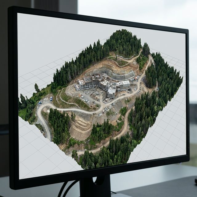
3D TEXTURED MESH — PHOTOGRAMMETRIC SITE RECONSTRUCTION
Who We Serve
Construction Project Managers
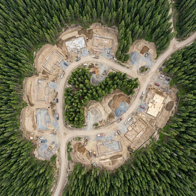
Weekly aerial documentation and progress reports for luxury builds, commercial developments, and infrastructure projects across Colorado.
Landscapers & Site Developers
Pre-construction site surveys, grading verification, and as-built documentation for residential and commercial landscape projects statewide.
General Contractors
Visual project documentation, stakeholder reports, and dispute resolution imagery for construction projects anywhere in Colorado.
Equipment & Processing
Common Questions
What is drone photogrammetry?
Drone photogrammetry uses overlapping aerial photographs processed through specialized software to create accurate 2D maps (orthomosaics) and 3D models (meshes) of a project site. It provides measurable, shareable visual documentation without the cost of traditional ground surveys.
How does a drone orthomosaic compare to satellite imagery?
Drone orthomosaics capture imagery at 1-2cm/pixel resolution — roughly 100× more detailed than commercial satellite imagery. They're also captured on your schedule, not dependent on satellite pass times, and can be flown under cloud cover.
How often should I schedule drone photogrammetry for construction progress?
Most construction projects benefit from weekly or bi-weekly flights. We offer retainer programs that lock in consistent scheduling, pricing, and deliverable formats — so your team gets reliable documentation throughout the entire build.
What software do you use for photogrammetry processing?
We process through DroneDeploy, Pix4D, and DJI Terra depending on project requirements. All platforms deliver survey-grade orthomosaics, 3D meshes, elevation models, and analytical reports exportable to CAD and GIS systems.
How accurate are 3D models from drone photogrammetry?
With RTK-corrected flight data, our 3D models achieve absolute accuracy of 2-5cm. Relative accuracy (measurements within the model) is typically within 1-2cm — sufficient for construction progress tracking, volumetric analysis, and design overlay comparisons.
Service Area
Weekly, monthly, and project-based retainer programs available. We serve mountain communities, Front Range cities, and job sites across all of Colorado.
Our Other Services
Map your construction site
Get a quote for drone photogrammetry anywhere in Colorado. We respond within 24 hours.
Request a Quote