
Route visitors into the right commercial lane
The public funnel now leads with packaged offers and direct CTA routing so solar, progress, LiDAR, and inspection requests land with the right intent before the contact form even loads.
Address-to-Quote Solar Review
Start from an address, roof imagery, or plans and route the job into quote-ready solar review instead of a generic contact path.
Repeat Solar Inspection / O&M Monitoring
Route thermal and repeat asset review requests into a service-aware intake with inspection context, site history, and ongoing follow-up.
Construction Progress Retainer
Push GCs and owner reps into repeat photogrammetry intake built for schedules, recurring flights, stakeholder reporting, and delivery continuity.
LiDAR Intelligence Package
Capture topo, terrain, and volumetric requirements up front so civil and site teams get clean scoping and a stronger path into project creation.
What We Fly
Show the workflow, not just the flight
Public pages now frame UpDrone around a concrete delivery sequence: structured intake, service-line execution, and portal-backed return of reports, files, and next actions.
Structured intake
Service-aware intake captures address, desired outcome, files available, and attribution so work enters the right lane from the start.
Model, map, or inspect
Each service line is framed around a concrete workflow: solar review, thermal diagnostics, lidar intelligence, or progress monitoring.
Portal-backed delivery
Quotes, files, reports, and follow-up activity are designed to return through the CRM and portal instead of disappearing into email threads.
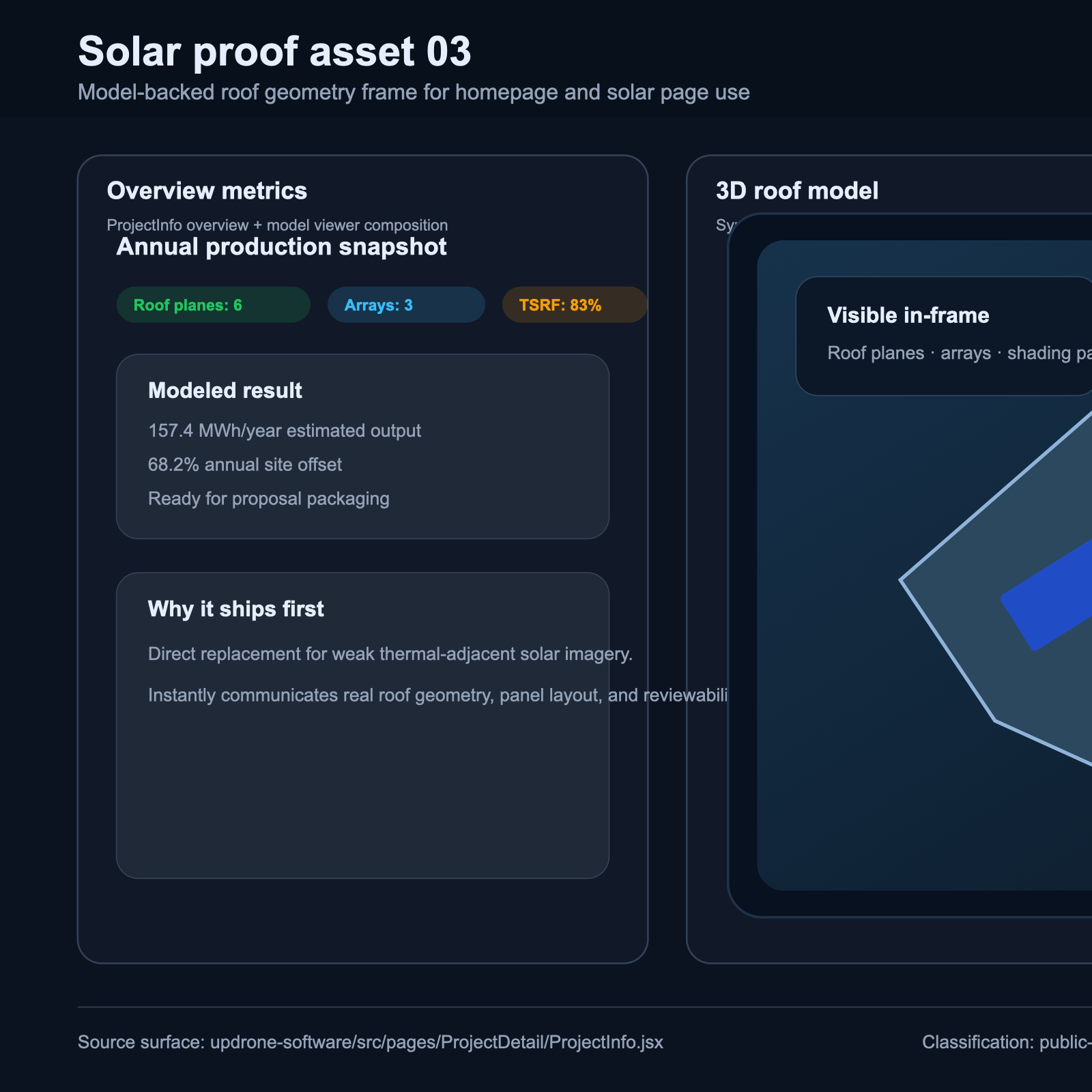
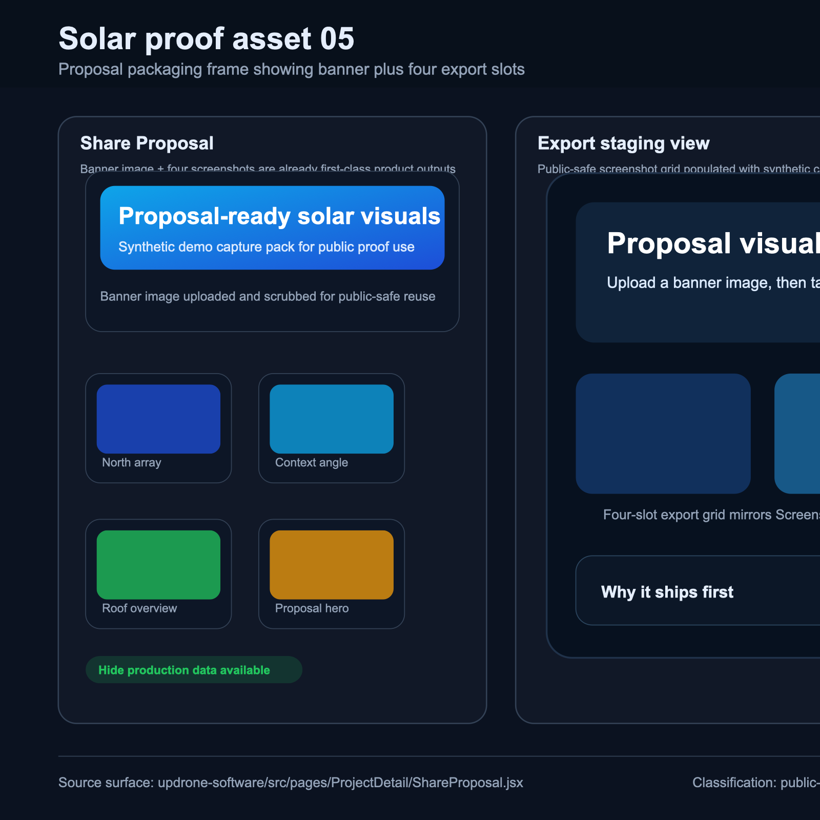
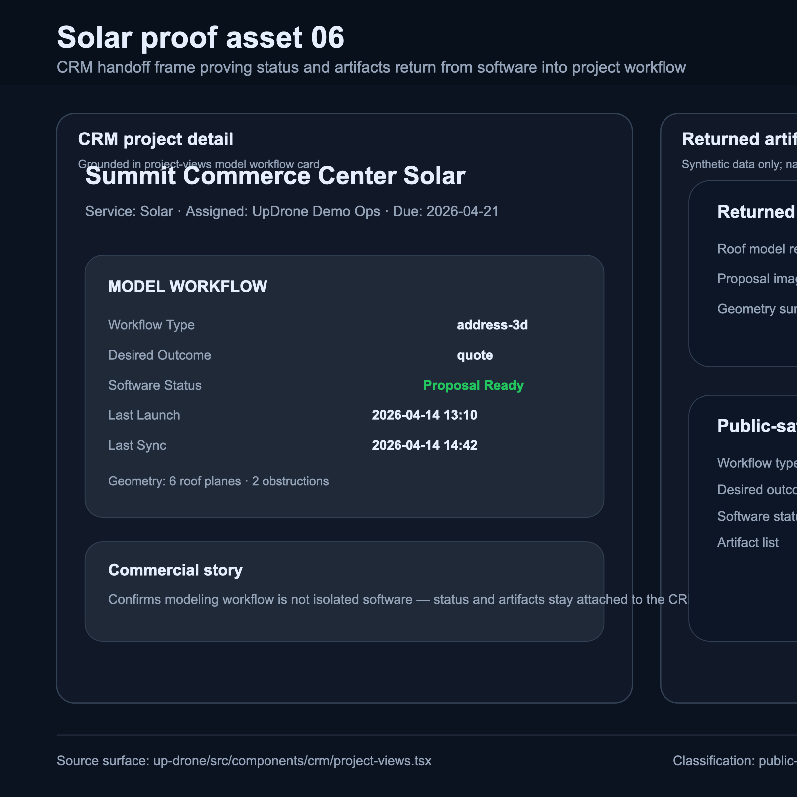
Address, model, proposal, and handoff story
The homepage now ships real public-safe solar proof frames so the flagship lane shows actual modeled output, proposal packaging, and CRM continuity.
First landing pages for priority buyers
Stay in one portal after the flight
UpDrone is not just a field capture vendor. We use a shared portal to carry quotes, project status, reports, repeat inspection history, files, and communication forward after intake so clients and internal teams stay aligned from request to delivery.
Quotes and approvals
Keep proposals, invoice status, and next commercial actions tied to the same project record instead of scattered across email.
Project tracking
See active jobs, milestones, due dates, progress, and upcoming field work in one operating view.
Deliverables and reports
Centralize uploaded files, reports, models, and client-ready project documents in one portal handoff.
Repeat inspection history
Build an ongoing record of prior flights, follow-up work, and recurring inspection activity across the same site.
Communication
Keep client and internal conversations attached to project context so updates and decisions are easier to recover.
Know what happens next without chasing email threads
Run delivery and follow-up from the same operating surface
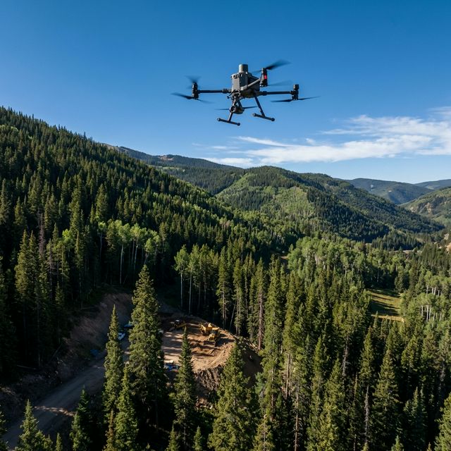
Built for the Mountains
UpDrone delivers high-precision aerial data services across all of Colorado — from luxury mountain builds in Vail and Aspen to Front Range development, solar farms on the Eastern Plains, and infrastructure across the Western Slope.
Based in Eagle County, our team combines deep drone operations experience with Colorado terrain expertise. We understand the altitude, the weather windows, and what your engineers and architects actually need.
Every project is a partnership — not a one-off flight. From pre-construction surveys to ongoing progress documentation, we're statewide and in it for the long build.
Our Equipment
Our Fleet & Capabilities
Project intake
Capture the site, available files, and commercial objective so the lead can be reviewed and routed into the right service lane.
Captures address-first, imagery, plans, and existing deliverables for clean CRM/project routing.